
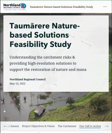
Restoring the Taumārere: Nature-Based Solutions for Flood Resilience and Community Well-being.
Award Finalists
2026 New Zealand Public Works Engineering Excellence Awards
We are thrilled that our framework for prioritising nature-based solutions has been selected as a finalist for the 2026 IPWEA NZ Excellence in Project Innovation Award.
By moving 'From Data to Decisions,' we have developed a world-leading approach that transforms complex environmental mapping into bankable infrastructure assets. This nomination reinforces our belief that high-resolution technical data is the key to unlocking long-term investment in our natural capital and community resilience.


2026 Stormwater Innovation Showcase Awards
We're proud to be a finalist for the 2026 Stormwater Innovation Showcase Award with this project. The 'Billion-Cell Concept' - a national-first spatial analysis framework processing over one billion data cells at 1m resolution across 492 km² - moves catchment restoration from ad hoc responses to strategically prioritised action. By embedding mātauranga Māori directly into the analysis alongside hydrodynamic modelling, the framework identifies where nature-based solutions can reduce peak flows, protect taonga species & build lasting resilience for flood-isolated communities.
Click the image to open PDF

Service Area: Environmental Engineering
Industry: Environmental Restoration / Flood Risk / Water Resources
Service: GIS Mapping & Analysis, NbS Assessment, On-farm Environmental Planning, Hydrology, Catchment-Scale Planning.
Location: Taumārere catchment, Far North, Northland
Deliverables:
Community engagement to ground the project in local issues
Hydrological assessment for climate resilience
Financial viability assessment, financial and monitoring frameworks developed
High-resolution relative environmental risk & NbS opportunity mapping
Catchment risk “hotspots” and restoration prioritisation maps
Case study site to test cost estimates, monitoring and funding, as well as hydraulic performance.
The Bottom Line
VISION's partnership with Ngāti Hine and community groups is setting the foundation for a resilient Taumārere catchment. Through the Billion-Cell Concept - a national-first spatial analysis framework processing over one billion data cells at 1m resolution across 492 km² - this project moves catchment restoration from ad hoc responses to strategically prioritised action. By combining high-resolution GIS analysis, hydrological expertise, and mātauranga Māori embedded directly into the computational framework, it maps practical opportunities for flood mitigation, water quality improvement, and biodiversity restoration.
Task
To identify risks within the catchment and map possible locations for NbS deployment across the Taumārere catchment - reducing flood risk, restoring ecological health, and strengthening cultural connections.
Problem
The Taumārere catchment faces multiple, interconnected challenges:
Flooding that isolates remote communities 6-7 times annually - despite over $7 million invested in civil infrastructure downstream.
Degraded water quality affecting rivers, kai (food gathering), and cultural values including tuna migration cues disrupted by delayed autumn rainfall.
Loss of wetlands, riparian cover, and biodiversity.
Traditional engineered flood mitigation that often fails to deliver ecological and community benefits.
Solution
VISION worked alongside Ngāti Hine and local groups to co-design a catchment-wide framework for implementing NbS. Key features included:
Three-Phased Approach: From community engagement and baseline data collection, to multi-criteria analysis (MCA) identifying 4 relative environmental risks and 8 NbS to resolve them, through to long-term financing planning.
Community Ownership: Ensuring solutions align with the aspirations of Ngāti Hine and local landowners - with mātauranga Māori and cultural indicators hard-wired directly into the computational weighting matrix, not treated as an afterthought.
Integrated Mapping: Using high-resolution terrain, hydrology, and land use data at 1m resolution to identify priority zones for NbS such as wetlands, riparian planting, erosion control, and floodplain reconnection. 2D-hydrodynamic modelling and eco-hydraulic validation confirmed NbS can achieve 15-20% peak flow reductions.
Financial Sustainability: Exploring funding streams, eco-tourism, and payment for ecosystem services to support long-term viability.
Benefits
Enhanced Ecological Health: Restored hydrology, improved water quality, and increased biodiversity - including refugia habitat for taonga species.
Community Well-being: Strengthened cultural connections, mahinga kai opportunities, and recreation spaces.
Flood Resilience: Natural solutions that slow, store, and filter water while reducing damage from extreme rainfall events.
Sustainable Future: A transparent, replicable model for catchment investment across Aotearoa - using smart technology to restore the natural mauri of our waters for generations to come.
Why It Matters
This project isn't just another report. It's a working example of what's possible when:
-
Local insight, mātauranga Māori, science, and restoration are combined from the start.
-
We process a billion data points to map risk and opportunity before spending money.
-
Solutions are selected for the unique environmental and cultural needs of the catchment.
-
We prove that nature-based solutions can be planned, costed, monitored, and delivered strategically - at a scale and resolution that stands up to scrutiny.


Dive Deeper: A Living Case Study
While the formal study provides the technical foundation, we believe in making our work accessible and transparent. Alongside the project, we developed an interactive StoryMap to share findings visually, engage the community, and bring the data to life for non-technical audiences.


Jonathan Cousins
Senior Hydrological Engineer,
MEng (Civil)
Go beyond the case study with our five-part technical series, written by the senior engineers who led the Taumārere project. We demystify Nature-based Solutions, starting with the project blueprint and a clear definition of what NbS means for Aotearoa.
Follow along as we show what these solutions look like on the ground, detail our innovative GIS mapping process for finding the right solution for the right place, and break down the real-world costs and funding pathways. This series is a practical blueprint for anyone looking to plan and deliver a successful catchment restoration project.
What Our Partners Say...

Suzie Hati-Scott
Ngā Tangariki o Ngāti Hine, Te Papa Pa Orooro
By asserting mana motuhake within our rohe, Ngāti Hine demonstrate how indigenous leadership, supported by digital innovation and collaborative engineering, can deliver enduring outcomes for catchment resilience, cultural integrity, and future generations.