

Part 3 - Catchment Placement of Nature-based Solutions
- Sep 30, 2025
- 4 min read
Updated: Oct 2, 2025
By Vision Consulting Engineers (VISION) • 30 Sep, 2025 • 4 min read

In This Article: - 4 Catchment Zones: How risks change from steep headwaters to tidal margins. - 8 NbS Interventions: Which specific Nature-based Solutions work best in each zone. - Sequencing the Solutions: Why NbS are most effective when applied in a whole-catchment order. - Management as a Tool: The role of 'NbS 9' (Catchment Management) to guide land activities.
How Do Catchments Behave from Source to Sea?
Nature-Based Solutions (NbS) use natural processes to reduce flood risk, improve water quality, and restore ecosystems. But they don’t exist in isolation. The best results come when NbS are placed in the right part of the catchment and designed to work together across the landscape.
In the Taumārere project, we assessed NbS as part of a whole-catchment restoration sequence. Each zone has its own physical characteristics, pressures, and opportunities for intervention:
Zone 1: Headwaters and Steep Hill Country - Focusing on Erosion Control
Steep, fast-draining slopes are prone to erosion, particularly after forestry harvest or where vegetation cover is thin. Heavy rain runs quickly off these hillsides, carrying sediment and debris into fragile headwater streams.
Zone 2: Mid-Catchment Valleys and Slopes - Managing Runoff and Nutrient Delivery
Rolling hills and valleys collect runoff from the headwaters, funneling it into tributaries. As flows converge, the potential for sediment transport and nutrient delivery increases. Agricultural activity and land use intensification amplify water quality pressures in these zones.
Zone 3: Wide Floodplains of the Lower Catchment - Reconnecting for Storage
Flat floodplains are natural water storage areas where rivers spread during floods. But in many places they’ve been drained, stopbanked, or developed, reducing their capacity to buffer peak flows. These areas remain highly productive farmland but face growing flood risk.
Zone 4: Intertidal and Coastal Margins - Building Coastal Resilience
At the river’s downstream end, tides, storm surges, and sea level rise shape the landscape. These brackish margins are ecologically rich and provide habitat for fish and birds, but are increasingly vulnerable to climate change and land use pressures including stopbanks that hold back the tide from the shore and drainage to allow "productive" land use to take place.


Our Eight NbS Types (Upstream to Downstream)
The Taumārere Catchment NbS Project identified eight practical interventions suited to different parts of the catchment:
Native Vegetation & Forest Planting: Stabilises soils, promotes infiltration, reduces runoff, provides carbon storage, and strengthens ecological corridors.
Steep Slope Erosion Control: Targeted planting, fencing, or stabilisation earthworks to prevent landslides and sediment loss.
Leaky Barriers: Timber or rock structures in headwater streams that slow the flow, trap debris, and recharge groundwater.
Silt Traps: Small engineered basins that intercept sediment and nutrients from farmland or forestry before reaching waterways.
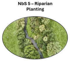
Riparian Planting: Native shrubs and trees along waterways to filter runoff, shade and cool streams, stabilise banks, and create habitat.
Floodplain Reconnection: Re-shaping land or removing stopbanks to give rivers room to spread during floods, reducing peak flows and supporting floodplain habitat.
Wetland Restoration: Natural sponges that hold water, filter sediment, support biodiversity, and provide long-term carbon storage.
Intertidal Wetland Restoration: Creating and expanding tidal wetlands as buffers against sea level rise, while providing nursery habitat for fish and coastal resilience.


The eight physical NbS types proposed for use in the Taumārere Catchment: Image credit: Vision Consulting Engineers
Beyond Infrastructure: NbS 9 – A Catchment Management Blueprint
We also included "NbS 9 – Catchment Management" in the project as an example of a land activities and management calendar. NbS 9 is not a spatially assessed, rather inferred from the MCA mapping for nutrient & pathogen relative risk and priority layers with management tools applied as required. The calendar is aimed to guide conversation around land management, environmental stressors, and the potential use of NbS to support the activity. The environmental triggers stated in the calendar are indicative only and must be informed by local knowledge as response to climate stress is dependent on-site setup and baseline conditions.
Targeting Risk, Unlocking Co-benefits: Why Placement of NbS Matters
The best results come when NbS are placed in the right part of the catchment and designed to work together across the landscape. You should consider that:
NbS work best in sequence — from erosion control in headwaters to wetland restoration and river reconnection on floodplains or migrating barriers in coastal zones.
They target risks where they occur, while unlocking wider co-benefits like biodiversity gains and cultural outcomes.
They provide a blueprint for smarter catchment-scale restoration in Northland and across New Zealand.

Explore the Complete Project:
This article is part of our five-part technical series on the Taumārere project. For a comprehensive overview, interactive maps, the full technical reports, and the project webinar, please visit our central case study hub.


Comments